
One week ago (5-6-17) I had a dilemma. I woke up to a warm and hazy morning, but it wasn’t hazy because of humidity. It was the haze of smoke – from the West Mims fire in the Okeefenokee National Wildlife Refuge, to be exact. There was a strong smell, and occasionally small flecks of gray ash would float down from the sky. It would have been an uncomfortable, and probably unhealthy, ride on any of my normal cycling routes. I would instead have to load my bike onto my car’s bicycle carrier and drive south and east.
One of my favorite places in my new state of Florida is the “GTM” – officially known as the Guana-Tolomato-Matanzas National Estuarine Research Reserve. It is just off of Florida’s Route A1A, which is a road that follows the entire Florida coast. It starts in KeyWest, heads northeast to Miami and then runs mostly north to Fernandina Beach. It ends just before you reach Ft. Clinch State Park and the St. Marys River outlet on the Florida/Georgia border. What I’ve seen of the road – I’ve gone as far south as Daytona Beach – is pretty spectacular. In countless sections you get a pretty good view of the ocean from the road. Near the GTM there are several parking areas with crosswalks across A1A where you can get over to the beach.
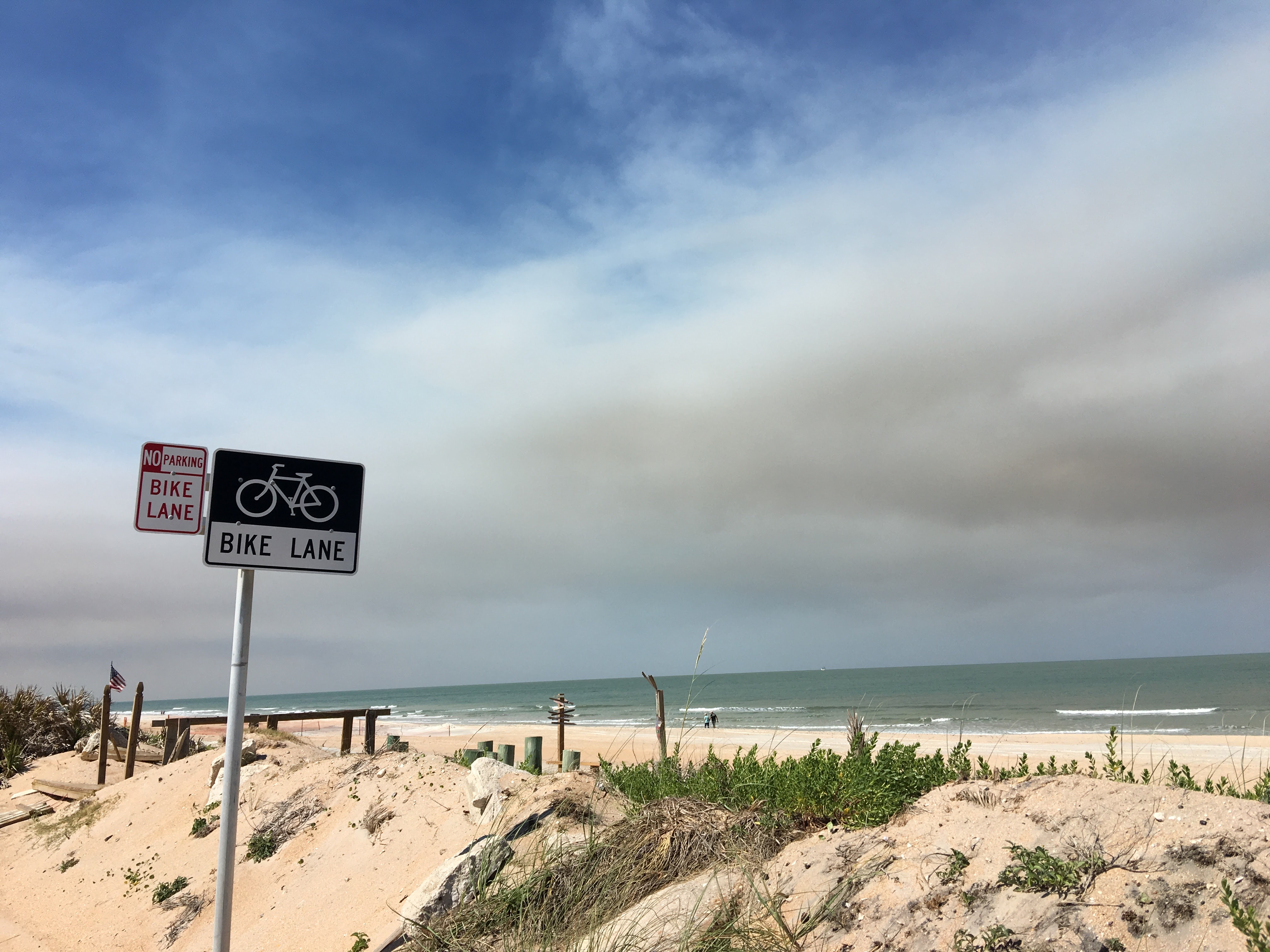
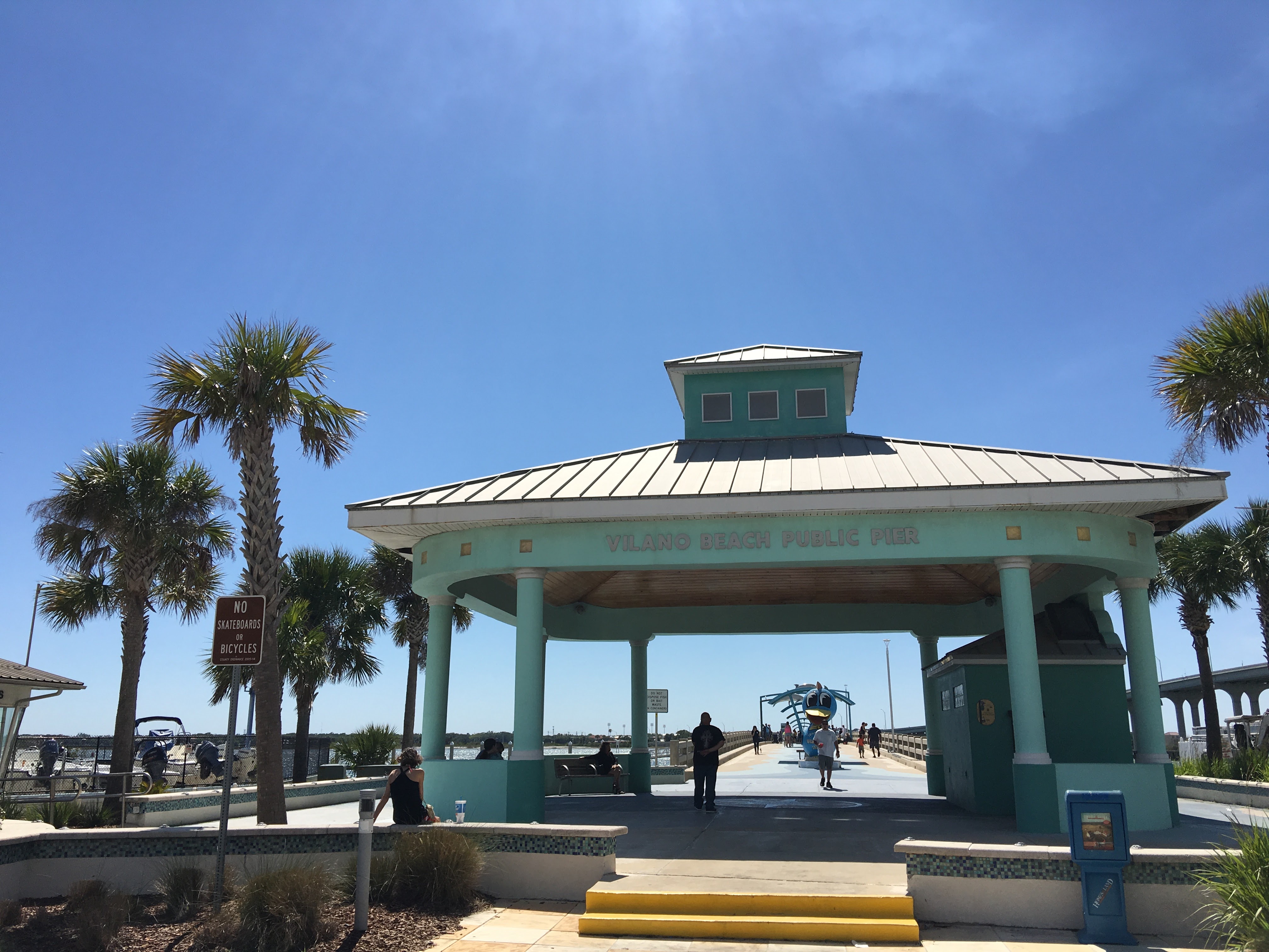
A1A also has bike lanes! And so with smoke filling the skies in Jacksonville I headed to the GTM to park, and then rode my bike south to a place called Vilano Beach, just north of St. Augustine. Overall about a 20-mile round trip of cycling. It turned out to be one of the nicest rides I’ve ever had, simply because of the scenery (and the weather). Traffic was relatively light, and though the speed limit through the area is 55 mph, the cars weren’t too annoying. Vilano Beach is a cute little village where the Tolomato river outlets into the Atlantic. There’s a nice pier that juts into the river (though I didn’t walk it this time).
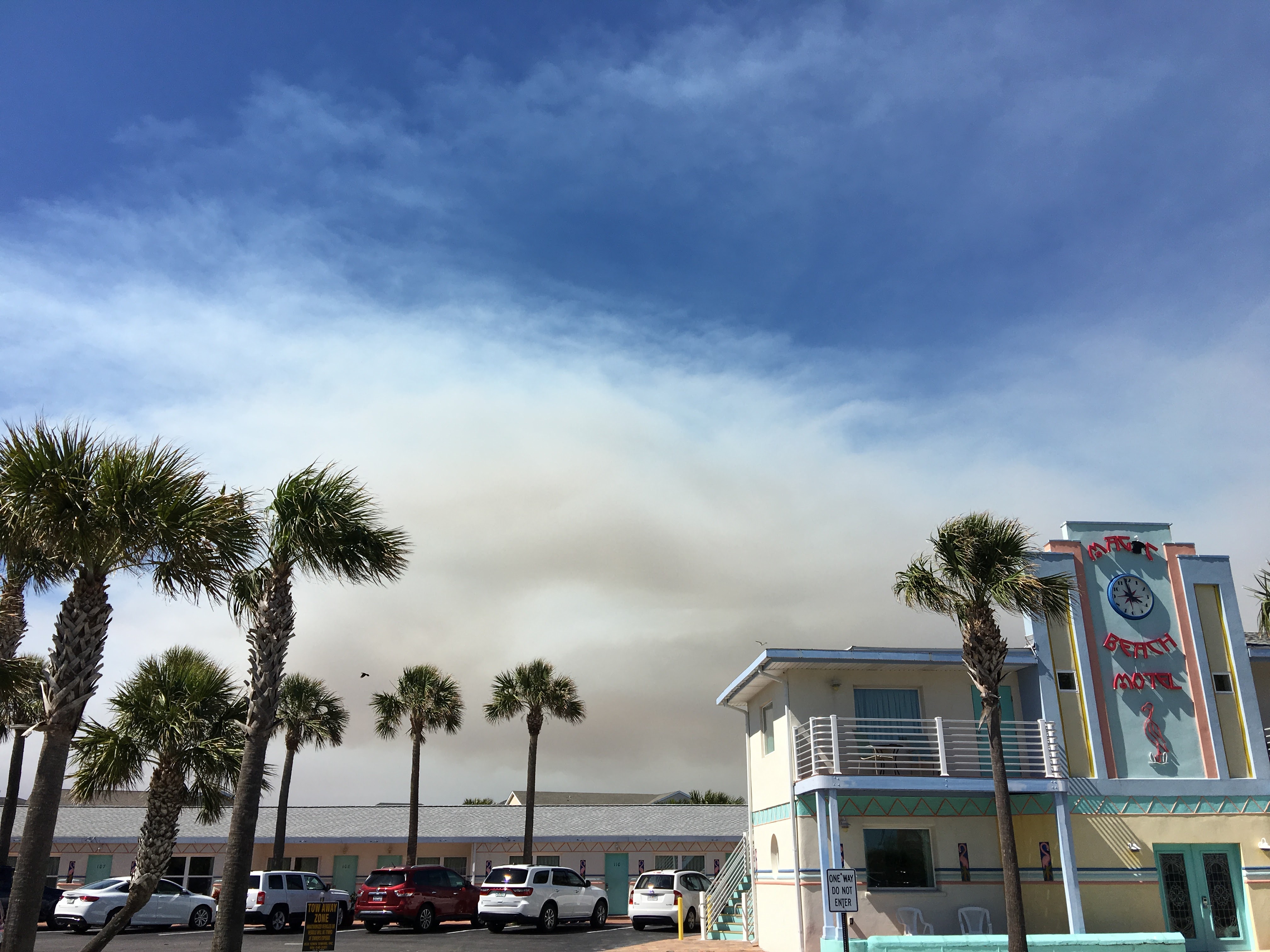
There is a cool looking retro/art deco hotel called the Magic Beach Motel located in Vilano Beach as well. In both of the photos you can see the slightly orange tinted smoke from the big fire.

After stopping to explore a bit more of the area, it was time to head back to the GTM. The picture at the top of this post was taken from the northbound bike lane, and as you can see, the ocean is in full view from the road (and so is the smoke – those aren’t clouds). The ride was slightly more difficult heading into the northwest wind, the one that was blowing the smoke southeast. After completing my ride, I put my bike back on the car. The drive north gave me a better view of what was hovering over Jacksonville.
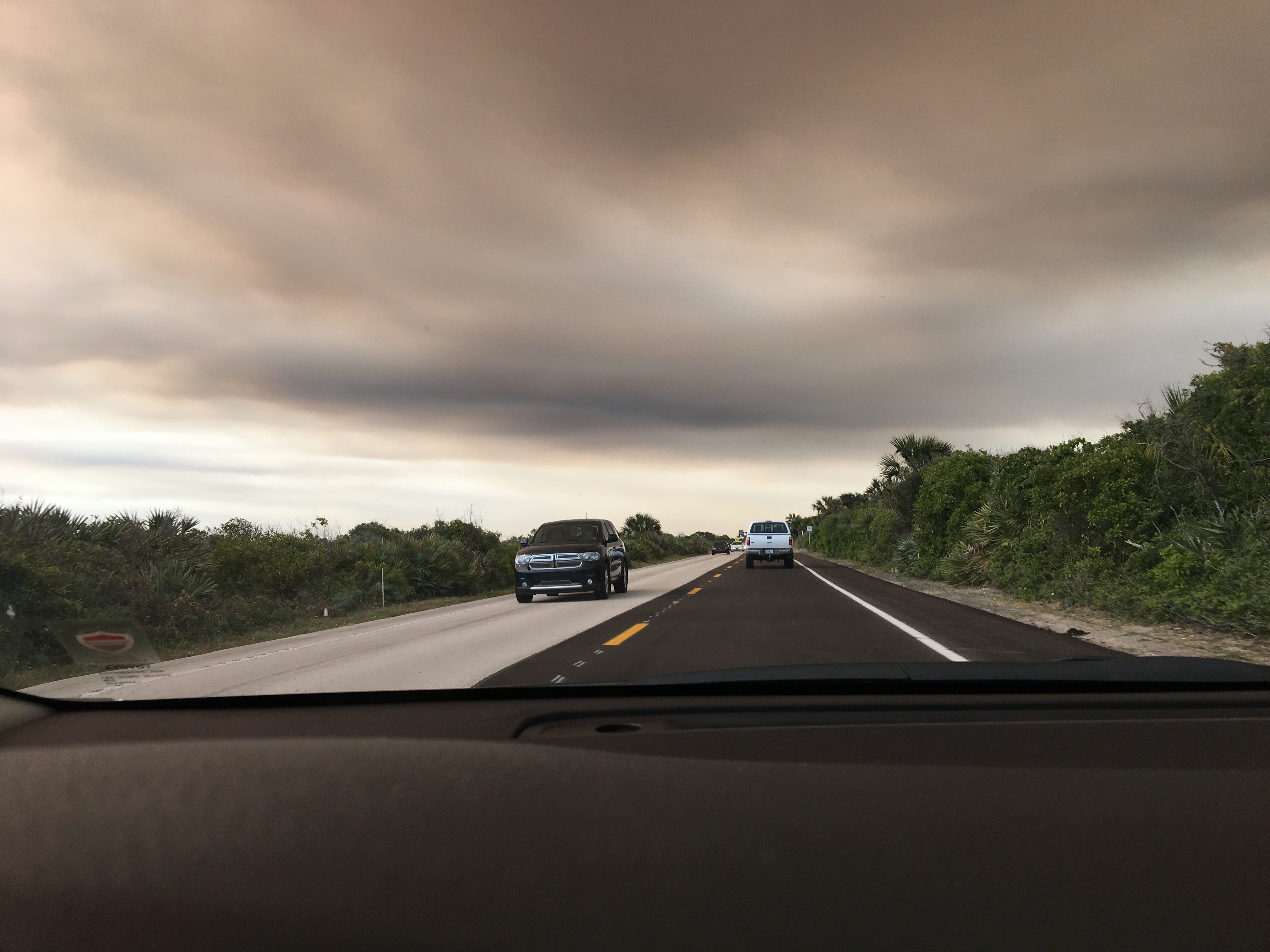
We’ve had varying amounts of haze and/or smoke filled skies since. Many residents of towns northwest of Jacksonville are still monitoring the fire to see if they’ll need to evacuate. They could use some rain, without the lightning, to knock down the fire a bit. The fire has burned almost 150,000 acres and it’s currently only about 15% contained.
When I used to train for cross-county running and track in high school, it was a matter of putting on running shorts, lacing up my shoes, stretching and heading out on the road. With cycling there is a bit more of a production, with filling water bottles, adding gloves, helmet, a pocketed jersey, and occasionally pumping tires. Add to that the concern over the smoke in the air, and there was the need to set up a bike carrier and get the bike safely and stably on the car. I had to drive a good 30 miles just to get to a healthier area to ride. In the end, it was truly worth it – and all trivial compared to what some residents, and of course the fire fighters have been dealing with.
So I consider myself lucky to have so many novel and fun places to ride. Next time maybe I’ll ride all the way into St. Augustine. Did I mention I was lucky?
4 Responses
I’ve been reading through Edwin Teale’s “American Seasons” and I’m in the section where he is travelling north with the spring starting in Florida. It was published in the 1950s and even then he talks about the many fires that blaze through that area of the south during the spring. From what I recall on that section much of the fires at the time (and maybe still are?) related to mans efforts to drain the areas of water, which as you can imagine, can lead to more fires in times of drought.
I suppose my comment isn’t really related to your amazing bike ride, but it feels a bit synchronous/serendipitous that you should blog about something recently on my mind.
Shannon!
I think my boss has recommended this book because of the north Florida references. It is amazing that all of this swamp land can be so dry, but that’s where we are. Summer monsoon season is coming, but they say things could still burn into October. Time will tell. Thanks for stopping by 😉
Listen, only I can blog and tweet about how awesome where I live is 🙂 Beautiful photos, and I want to spend a night at the Magic Beach Motel, sometimes you can’t compete with some solid OG American architecture form the 50s or 60s?
Glad thanks are good in your hood, I miss you sometimes. But only sometimes.
Jim – I miss you sometimes too.